Mostrar el registro sencillo del ítem
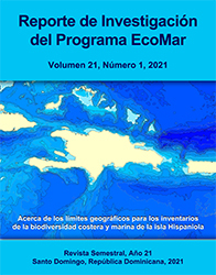
Acerca de los límites geográficos para los inventarios de la biodiversidad costera y marina de la isla Hispaniola
| Licencia | Creative Commons (CC) BY-NC-ND. [Español] Debe reconocer adecuadamente la autoría citando adecuadamente esta fuente. No se permite la generación de obras derivadas ni hacer un uso comercial de la obra original. [English] You must give appropriate credit to the authors properly citing this source. You may not use this document for commercial purposes. The generation or distribution of derivative works is not allowed. | es |
| Autor | Herrera-Moreno, Alejandro | |
| Fecha de admisión | 2022-04-07T20:03:04Z | |
| Fecha disponible | 2022-04-07T20:03:04Z | |
| Año | 2021 | |
| Citación | Herrera-Moreno, A. (2021). Acerca de los límites geográficos para los inventarios de la biodiversidad costera y marina de la isla Hispaniola. Reporte de Investigación del Programa EcoMar, 21(1), 1-7. Recuperado de: | es |
| URI | https://bvearmb.do/handle/123456789/819 | |
| Sinopsis | [Español] Se ofrecen pautas para establecer los límites geográficos de los inventarios de la biodiversidad costera y marina de la isla Hispaniola combinando las capas de: i) las Zonas Económicas Exclusivas de República Dominicana y Haití (más el espacio de reclamación de Navassa) que brindan límites jurisdiccionales; ii) las áreas marinas de la Organización Hidrográfica Internacional que incorpora criterios oceanográficos y iii) la Carta Batimétrica General de los Océanos que añade un factor fundamental en la distribución de los organismos marinos: la topografía submarina. Se ofrecen las referencias de descarga de datos así como mapas que pueden ser utilizados en futuros inventarios. | es |
| Sinopsis | [English] Guidelines are offered to establish the geographical limits of the coastal and marine biodiversity inventories of Hispaniola island, combining the layers of: i) the Exclusive Economic Zones of Dominican Republic and Haiti (plus the overlapping claim of Navassa) that provides jurisdictional limits; ii) the marine areas of the International Hydrographic Organization that incorporates oceanographic criteria and iii) the General Bathymetric Chart of the Oceans that adds a fundamental factor in the distribution of marine organisms: submarine topography. References are provided for downloading data as well as finished maps that can be used in future inventories. | es |
| Idioma | Spanish | es |
| Publicado | Reporte de Investigación del Programa EcoMar [ISSN: 2737-6605], 21(1), 1-7. | es |
| Derechos | © Alejandro Herrera-Moreno. | es |
| URI de derechos | https://creativecommons.org/licenses/by-nc-nd/4.0/deed.es | es |
| Materia | Biodiversidad - República Dominicana | es |
| Materia | Recursos marinos | es |
| Título | Acerca de los límites geográficos para los inventarios de la biodiversidad costera y marina de la isla Hispaniola | es |
| Tipo de material | Article | es |
| Tipo de contenido | Scientific research | es |
| Acceso | Open | es |
| Audiencia | Technicians, professionals and scientists | es |
Ficheros en el ítem
Este ítem aparece en la(s) siguiente(s) colección(es)
-
Investigación ambiental [1758]
La consulta y descarga de este documento están sujetas a esta licencia: Creative Commons (CC) BY-NC-ND. [Español] Debe reconocer adecuadamente la autoría citando adecuadamente esta fuente. No se permite la generación de obras derivadas ni hacer un uso comercial de la obra original. [English] You must give appropriate credit to the authors properly citing this source. You may not use this document for commercial purposes. The generation or distribution of derivative works is not allowed.
© Alejandro Herrera-Moreno.
© Alejandro Herrera-Moreno.


![Creative Commons (CC) BY-NC-ND. [Español] Debe reconocer adecuadamente la autoría citando adecuadamente esta fuente. No se permite la generación de obras derivadas ni hacer un uso comercial de la obra original. [English] You must give appropriate credit to the authors properly citing this source. You may not use this document for commercial purposes. The generation or distribution of derivative works is not allowed.](/themes/Mirage2//images/creativecommons/cc-generic.png)