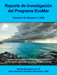
Pautas para integrar la vulnerabilidad climática en los planes regionales de ordenamiento territorial en República Dominicana
| License | Creative Commons (CC) BY-NC-ND. [Español] Debe reconocer adecuadamente la autoría citando adecuadamente esta fuente. No se permite la generación de obras derivadas ni hacer un uso comercial de la obra original. [English] You must give appropriate credit to the authors properly citing this source. You may not use this document for commercial purposes. The generation or distribution of derivative works is not allowed. | es |
| Author | Herrera-Moreno, Alejandro | |
| Accessioned date | 2022-04-07T19:46:15Z | |
| Available date | 2022-04-07T19:46:15Z | |
| Year | 2020 | |
| Citation | Herrera-Moreno, A. (2020). Pautas para integrar la vulnerabilidad climática en los planes regionales de ordenamiento territorial en República Dominicana. Reporte de Investigación del Programa EcoMar, 20(2), 1-22. Recuperado de: | es |
| URI | https://bvearmb.do/handle/123456789/817 | |
| Abstract | [Español] Se ofrecen pautas para integrar la vulnerabilidad climática en el diagnóstico territorial del Plan Regional de Ordenamiento y Desarrollo Territorial a través de un ejercicio de superposición de capas que relaciona espacialmente el mapa de la división del país en diez regiones de desarrollo, basada en consideraciones geográficas, socioeconómicas y culturales, con otros mapas que describen componentes del contexto físico-natural (clima, geología e hidrología), riesgos (sequía, inundaciones, huracanes o incendios forestales), características de la zona costera-marina o situación con la frontera haitiana. Esta aproximación permite combinar factores de gestión, ambientales y climáticos que explican la vulnerabilidad regional a la vez que aporta información esencial para el diagnóstico. | es |
| Abstract | [English] Guidelines to integrate climate vulnerability in the territorial diagnosis of the Regional Land Use and Development Plan, are offered, through a layer overlapping exercise that spatially relates the country's map division into ten planning regions, based on geographic, socioeconomic and cultural considerations, with other maps that describes components of the physical-natural environment (climate, geomorphology, hydrology and watersheds), risks (drought, floods, hurricanes or forest fires), characteristic of the coastal-marine zone and situation to the Haitian border. This approach allows to combine management, environmental and climatic factors that explain the regional vulnerability while providing essential information for the territorial diagnosis. | es |
| Language | Spanish | es |
| Published | Reporte de Investigación del Programa EcoMar [ISSN: 2737-6605], 20(2), 1-22. | es |
| Rights | © Alejandro Herrera-Moreno. | es |
| Rights URI | https://creativecommons.org/licenses/by-nc-nd/4.0/deed.es | es |
| Subject | Gestión ambiental - Planificación | es |
| Subject | Cambio climático | es |
| Subject | Impacto ambiental | es |
| Title | Pautas para integrar la vulnerabilidad climática en los planes regionales de ordenamiento territorial en República Dominicana | es |
| Material type | Article | es |
| Type of content | Scientific research | es |
| Access | Open | es |
| Audience | Technicians, professionals and scientists | es |
Files in this item
This item appears in the following Collection(s)
-
Investigación ambiental [1758]
Access and downloading this document are subject to this license: Creative Commons (CC) BY-NC-ND. [Español] Debe reconocer adecuadamente la autoría citando adecuadamente esta fuente. No se permite la generación de obras derivadas ni hacer un uso comercial de la obra original. [English] You must give appropriate credit to the authors properly citing this source. You may not use this document for commercial purposes. The generation or distribution of derivative works is not allowed.
© Alejandro Herrera-Moreno.
© Alejandro Herrera-Moreno.


![Creative Commons (CC) BY-NC-ND. [Español] Debe reconocer adecuadamente la autoría citando adecuadamente esta fuente. No se permite la generación de obras derivadas ni hacer un uso comercial de la obra original. [English] You must give appropriate credit to the authors properly citing this source. You may not use this document for commercial purposes. The generation or distribution of derivative works is not allowed.](/themes/Mirage2//images/creativecommons/cc-generic.png)