/admin/item?itemID=162c5d92-7aff-4bea-be4a-8dbf882a9b84
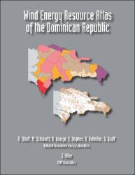
Wind energy resource atlas of the Dominican Republic

Ver/
Tipo de acceso
AbiertoTipo de Material
LibroTipo de Contenido
Informe técnicoIdioma
InglésAudiencia
Técnicos, profesionales y científicosColección
- Gestión ambiental [2925]
Metadatos
Mostrar el registro completo del ítem| Sinopsis: | The Wind Energy Resource Atlas of the Dominican Republic identifies the wind characteristics and the distribution of the wind resource in this country. This major project is the first of its kind undertaken for the Dominican Republic. The information contained in the atlas is necessary to facilitate the use of wind energy technologies, both for utility-scale power generation and off-grid wind energy applications. A computerized wind mapping system developed by NREL generated detailed wind resource maps for the entire country. This technique uses Geographic Information Systems (GIS) to produce high-resolution (1-square kilometer) annual average wind resource maps. |
| Autor(es): | Elliott, D.
Schwartz, M. George, R. Haymes, S. Heimiller, D. Scott, G. Kline, J. |
| Año: | 2001 |
| Publicado: | Golden, CO (United States): National Renewable Energy Lab (NREL), U.S. Department of Energy |
| Citación: | Elliott, D. et al. (2001). Wind energy resource atlas of the Dominican Republic. Golden, CO (United States): National Renewable Energy Lab (NREL), U.S. Department of Energy. Recuperado de: |
| URI: | https://bvearmb.do/handle/123456789/3438
|

